Historical cartography is one of the hallmarks of the Historical Soundscapes digital platform. The geolocation on these maps is more or less complex depending on the detail and precision with which they have been drawn up. We will progressively incorporate the maps of those cities that significantly increase the number of locations and that have historical maps that are of interest for this project.
Below we provide brief information about the historical maps available to users at the moment.
Of unknown author, it shows the layout of the city, indicating the names of some of the most important gates, squares, and streets and drawing only a small number of significant buildings in a more precise manner.
https://catalegarxiumunicipal.bcn.cat/ms-opac/permalink/1@739646
Plan topográphico de la ciudad de Córdoba. Levantado según procedimientos de geometría subterránea por el ingeniero de minas barón de Karvinski y el ingeniero de puentes y calzadas don Joaquín Rillo a expensas de la municipalidad. Año 1811. Escala de cien estados decimales de a dos varas castellanas cada uno.
This is the most complete and precise map of Cordova that has been preserved, in which the urban layout of the modern city can be seen in great detail. Due to its state of preservation, what we use is a reproduction made from this map, in which its original layout has been altered since the river is located at the top. It is also known as the “map of the French”. The original document has dimensions of 184 x 226 cm, composed of sixteen fragments of paper, adhered to a canvas support on a stretcher.
https://repositorio.iaph.es/handle/11532/379775
The hypothetical floor plan of the mosque of Almanzor (10th century) was made by Antonio Almagro Gorbea. It is available in the series Arquitectura Al-Andalus of the Real Academia de Bellas Artes de San Fernando. It represents the state in which the enclosure of the mosque was when it was consecrated after the conquest of the city by King Ferdinand III in 1236. In this floor plan, we will georeference all the items until 1607, when the altar and choir of the Gothic cathedral were moved to their new location in the center of the sacred precinct.
https://www.academiacolecciones.com/arquitectura/inventario.php?id=AA-101_21
The plan of the Cathedral of Cordova, commissioned by Bishop Pedro de Salazar y Góngora in 1741, is the first complete graphic representation of the cathedral's floor plan that has been preserved. It is an anonymous oil painting, preserved in the archives of the Cathedral of Cordova, measuring 103 x 165 cm, with a representation of the bell tower on the left. This detailed plan provides us with numerous significant elements of the cathedral space. In addition to the chapels and other liturgical spaces, it depicts the fountains, altars, doors, etc. Especially relevant is the location of the burials distributed throughout the sacred precinct, drawn with dotted lines.
We are grateful to the Cathedral of Cordova Chapter for providing us with the reproduction of this plan and the permission to use it in the georeferencing of the cathedral liturgical spaces in the digital platform Historical Soundscapes.
Cantizani Oliva, Juan; Reinoso Gordo, Juan Francisco and Gámiz Gordo, Antonio, “The First Scientific Plan of the Mosque-Cathedral of Córdoba: Graphic and Dimensional Analysis of an Oil Painting from 1741”, Frontiers of Architectural Research 12 (2023), 587-600.
This plan of the Cathedral of Cordova was drawn by the architect Juan Pedro Arnal Ardi (1735-1803), a student at the Academia de San Fernando and later an academician of merit for architecture at this institution. He traveled to Cordova, commissioned by the Academy, in 1766, at which time he drew the plan that concerns us. It was executed on light-yellow laid paper and measures 52.3 x 72.6 cm. At the top, in ink: “AE gravada por D. Jph Gonzalez”.
The copy we are using of the original document (sig. MA-0536) is digitized in high resolution on the website of the Academia de San Fernando.
https://www.academiacolecciones.com/dibujos/inventario.php?id=MA-0536
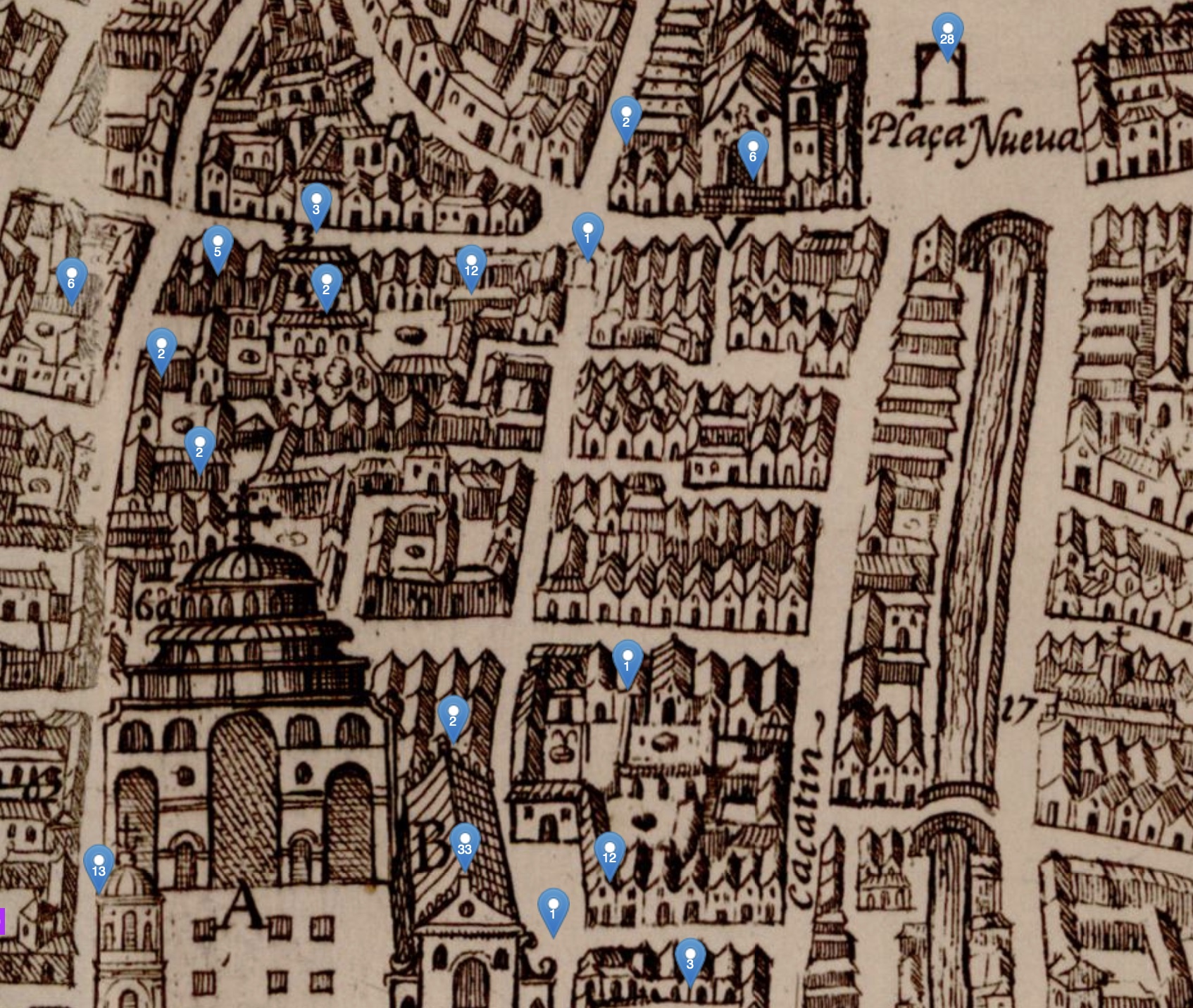
The map of the city of Granada, drawn by Ambrosio de Vico, was commissioned by Archbishop Pedro de Castro and accords well with the prevailing Counter-Reformation spirit of the time. It tacitly aimed to present the streets of Granada as an extended religious space in keeping with the spirit of Baroque ceremonial, and thus the sacred buildings are represented in much greater detail than those of municipal institutions or private residences. This map was destined to illustrate Justino Antolínez’s Historia eclesiástica de Granada (completed in 1611 although it was never published), a work whose primary aim was to justify the religious legitimacy of Granada, linking the city to the very origins of Christianity and simply passing over the centuries of Islamic occupation. The exact dates for either the drawing or the first engraving are unknown, but the drafting by the architect Ambrosio de Vico can be dated between 1590 and 1612, with some further details added when Francisco Helyan was about to produce the two copper plates towards 1612-1613. The plan measures 44.5 x 65 cm.
López Guzmán, Rafael J.; Gómez-Moreno Calera José Manuel and Moreno Garrido, Antonio, “La plataforma de Ambrosio de Vico: cronología y gestación”, Arquitectura Andalucía Oriental 2 (1984), 6–13.
Gómez-Moreno Calera, José Manuel. El arquitecto granadino Ambrosio de Vico. Granada: Universidad de Granada, 1992.
Calatrava, Juan and Ruiz Morales, Mario. Los planos de Granada 1500-1909. Granada: Diputación Provincial de Granada, 2005.
In this map, Francisco Dalmau, a mathematics teacher with outstanding technical, scientific, historical, and artistic knowledge, achieved excellent results and marked a turning-point in the urban cartography of the city of Granada. It was drawn up at the request of the city council. It is a large-format map measuring 358 by 243 cm. An engraving of the original was made in Madrid by Francisco Ribera, on a scale of one-sixteenth of the original. It presents important innovations in cartography, including the fact that it was the first city plan realized according to topographical criteria. The map shows the planimetry of the most important sacred and civil buildings and includes the visible irrigation channels of the city and urban environment, as well as the network of main roads, and marks the cultivated areas with symbols to indicate vegetation, furrows, and ploughing.
García Pulido, Luis José. “Una precisa y artística representación gráfica del territorio granadino: el Mapa topográfico de la ciudad de Granada y su término de Francisco Dalmau (1819)”, Cuadernos de Arte de la Universidad de Granada 40 (2013), 171-198.
The Mantua Carpetanorum sive Matritum Urbs Regia known as the map by Pedro de Texeira was probably commissioned by King Philip IV from this Portuguese cartographer. The preparation of the plan must have begun around 1648. It measures 180 x 285 cm (copy from the Biblioteca Nacional de España) and its scale is c. 1:1,840. It is drawn in perspective from the south of the city. Texeira must have finished his measuring and drawing work around 1653 and it depicts the geometric plan of the town, to which the elevations of the buildings and the internal distribution of the blocks were added in singular detail. The engraving process was carried out in Antwerp by Salomon Savery and the printing was done in the workshops of Jan and Jacob van Veerle. The engraving was executed on twenty plates measuring 57 x 24 cm, with slight differences between them, resulting in slight defects in the fit between them.
Vidaurre Jofre, Julio. El Madrid de Velázquez y Calderón. Vol. II. El plano de Texeira: lugares, nombres y sociedad. Madrid: Ayuntamiento de Madrid y Fundación Caja Madrid, 2000.
Gea Ortigas, María Isabel. Guía del Plano de Texeira, 4ª edición. Madrid: La Libería, 2019.
The first complete detailed plan of the city of Seville, commissioned in 1768 by its local administrator Pablo de Olavide, was completed in a rigorously scientific manner by the engineer Francisco Manuel Coello and engraved by José Amat in 1771. It measures 86 x 108 cm (copy of the Biblioteca Nacional de España) and its scale is c. 1:2,600. This map reflects very precisely the urban fabric of the city, combines the representation of blocks, orchards, and roads with the more or less schematic elevation of religious and municipal buildings, and even included what today is termed street furniture.
Ollero Lobato, Francisco; Pro Jiménez, Reyes y Caballero Gómez, Gumersindo. 250 años de la creación del Plano de Pablo de Olavide en Sevilla (1771-2021). Sevilla: Fundación de Municipios Pablo de Olavide, 2021.
The Valentia edetanorum aliis contestanorum, vulgo del Cid map was drawn up in 1704 by the mathematician, cosmographer and architect Tomás Vicente Tosca. It had a precedent in the Nobilis ac regia civitas Valentie in Hispania, dated 1608 and whose draftsman or engraver was Antonio Manceli. Tosca's map was commissioned by the Valencia City Council. It is a meticulous plan that constitutes a vertical projection of the street map and in which the buildings are depicted in perspective, with greater or lesser detail and fidelity according to their importance, also incorporating crops and trees. The map we are mapping is the original drawn by Tosca in pen and slightly colored with watercolor and measures 203.5 x 267.5 cm, with an approximate scale of 1:810.
El plano de Valencia de Tomás Vicente Tosca (1704). Coordinate by Joan J. Gavara. Valencia: Generalitat Valenciana, 2003.
Rosselló, Vicenç M., “Tomàs V. Tosca y su entorno ilustrado en Valencia. Obra autógrafa y atribuciones”, Ería 64-65 (2004), 159-176.
Ventura Seco, cartographer and notary to the king, completed the map of Valladolid on 20 November 1738. For its production, he had measured, one by one, all the streets, squares and surroundings of the city in order to produce an accurate map of the city. The only manuscript copy measures 110 x 80 cm and its scale is 1:3,500. It shows the layout of the streets and the projection of the elevations of the buildings, as well as the fields and roads that bordered the city centre.
Balsa Carrera, José María. Bentura Seco y su mapa de Valladolid. En testimonio de verdad. Valladolid: Ayuntamiento de Valladolid, 2014.
Granada. Map by Ambrosio de Vico (c. 1600)